|
||||||||||||
|
Home | ||||||||||||
  
|
||||||||||||||||||||||||||||||||||
|
|
||||||||||||||||||||||||||||||||||
|
Central Croydon |
||||||||||||||||||||||||||||||||||
|
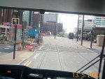
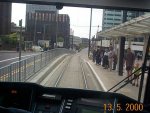
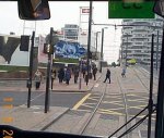
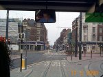
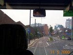
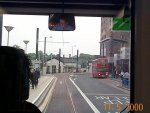
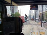
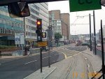
Driver Eye Views |
||||||||||||||||||||||||||||||||||
|
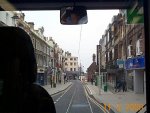
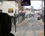
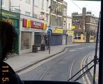
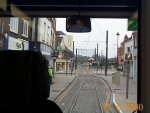
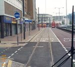
All Pictures are © S.J.Parascandolo and are taken from the passenger saloon Sandilands - George Street/Wellesley Road
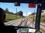
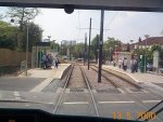
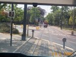
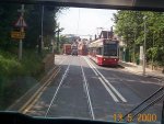
Trams from the east approach Sandilands Junction in two directions along the alignment of the former Woodside and South Croydon Railway which is in a deep cutting. Trams from New Addington approach from the south with trams from Beckenham and Elmers End from the north. Tramlink has taken some land here to open out a new cutting at right angles to the existing one. Trams can now turn sharply from each direction and climb up the new cutting to Sandilands Junction before crossing Woodbury Close LC. This is the summit and trams then enter Sandilands tram stop which is at road level adjacent to the busy A232. At this point, the tram way becomes a street tramway and block paving is used rather than ballast as it runs in front of flats parallel to the road. This area has been landscaped well. There is an emergency crossover here which is often used in case of a problem on the street section ahead. Trams now reach Chepstow Road which is a 5 way Road Junction (one road with trams in) plus a segregated tramway! Getting traffic priority right here has always been a problem. It was formerly a roundabout but is now a signalled junction with the main routes being the A232 and the trams from their segregated alignment into Addiscombe Road. Addiscombe Road is one of the most traditional sections of Modern Tramway in the UK. It is also a model of public transport planning. All through traffic has been diverted to the main A232 but full access is still allowed to the quiet residential area. All public transport into Croydon from this direction now uses this road allowing a free flow of buses and trams. The road is much quieter than it was before Tramlink opened. The road has many locations for excellent photography, a quiet pub, The Cricketers to sit and watch the trams and half way along, staggered platforms for Lebanon Road Stop. Bus stops have special bays to allow buses to pull in clear of the trams. After leaving Lebanon Road, trams descend slightly to the junction with Cherry Orchard Road. This used to be a roundabout around the unusually shaped NLA tower. Now, all through traffic runs North - South along Cherry Orchard Road and trams occupy the northern part of the old roundabout on segregated track. There is traffic light control to get trams over Cherry Orchard Road. Trams run on segregated track in front of the post office before another signalled junction at Taxi Rank where taxis and cars dropping off passengers for the station cross. All westbound trams stop here to request via a button on the trams VECOM, a platform at East Croydon. East Croydon has a reversible centre platform which is very useful to turn trams short in case of a problem or delays, to stable a failed tram, to swap trams over or as usually happens to boost capacity for westbound trams. East Croydon stop is located outside the busy station and on the bridge over the Brighton mainline. After East Croydon, trams continue over Dingwall Road LC and along George Street East. They have sole use of the north side of the road which was formerly a dual carriageway and is now restricted to local traffic and public transport. After passing the Dingwall Road emergency crossover and the Tramlink Shop on the left, trams reach the Wellesley Road/George Street junction - the start of the Croydon Loop. Westbound trams now follow the single westbound track on the south side of the loop while eastbound trams will have turned into George Street East from Wellesley Road and the single track north side of the loop.
Croydon Loop (South Side)
From George Street East, trams cross the busy junction with Wellesley Road which is above the Croydon Underpass. They then enter George Street West which is a much older, narrower road. It is on paper at least pedestrianised for most of the day with Loading in the evenings and at night although this is widely abused! Loading bays are provided to keep vehicles clear of trams. Overhead wires are strung between the old buildings in this street. George Street stop is a short distance down the road on the right hand side of the tram outside the entrance to Alders. This is one of the busiest stops for shoppers to access the Whitgift Centre but the stop is small and often overcrowded. If the planned Park Place redevelopment takes place, this stop will be moved and enlarged. Now for the best part of the system, trams pass the ancient Whitgift Almshouses and cross North End - The pedestrianised main shopping street. Trams used to operate along North End until 1951 as part of the trunk London - Purley route. Tramlink however, now descends the pedestrianised Crown Hill. At 9%, it is the steepest part of the system and with dopy shoppers, can be an interesting ride! It certainly keeps the drivers on their toes. Trams now enter Church Street with traffic light control at Middle Street and Frith Street and pass the famous Surrey Street market on the left. They continue with normal traffic now along Church Street, past my favourite McDonalds restaurant and into Church Street Stop which is segregated. Note the "Tramms" shopping precinct on the right here - no one is sure why they can't spell "Trams"! Beyond Church Street, the tramway splits into Interlaced track. This is provided to avoid a point mechanism in the middle of a road junction. The interlaced tracks cross Drummond Road Level Crossing before they diverge in front of Reeves furniture store. Trams to Wimbledon, go straight ahead, crossing Tamworth Road and running into Cairo New Road towards Wimbledon. Trams going round the loop, turn sharply to the right and join the line from Wimbledon and Reeves Corner Stop in Tamworth Road.
Croydon
Loop (North Side)
After the two routes converge in Tamworth Road, they run along the road towards West Croydon. This road was actually built as part of the Surrey Iron Railway in 1803. Initially, it is shared with other traffic but at Middle Street, becomes Tram and Bus only. Trams now pass the site of Tamworth Road stop. This is being constructed together with a bus interchange for the new Centrale Shopping Centre on the right of the line. It should open in 2003. At the top of Tamworth Road, trams cross the other end of North End and enter Station Road at West Croydon under traffic light control. They run along station road to a stop apposite West Croydon Bus Station. This area is often congested with illegal parking and buses and the interchange with West Croydon station is far from ideal. Leaving the stop, trams run between the large Prospect West and Delta Point offices of BT and turn right from Station Road into Wellesley Road under traffic light control. Trams run along the central reservation of Wellesley Road which is a busy dual carriageway. There is traffic light control of first a signalled North - South U-Turn at Delta Point and then the Right Turn from Poplar Walk into Wellesley Road. They continue until after the Whitgift centre where at the junction with Landsdown Road, they cross with traffic lights side of the southbound carriageway and for Wellesley Road stop which is on the slip road for buses only to the junction above the underpass. After leaving the stop, they run up the slip road and turn left into George Street East where the south side of the loop diverges. |
||||||||||||||||||||||||||||||||||
|
Where do you want to go now? |
||||||||||||||||||||||||||||||||||
|
Wimbledon | Through the Depot | New Addington | Beckenham / Elmers End |
||||||||||||||||||||||||||||||||||
|
|
||||||||||||||||||||||||||||||||||
| Designed by Trapdoor Internet Services |
