|
||||||||||||
|
Home | ||||||||||||
  
|
|
|
|
The New Addington Branch |
|
Driver Eye Views |
|
All Pictures © S.J.Parascandolo and are taken from the passenger saloon
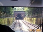
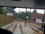
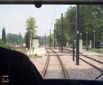
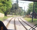
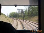
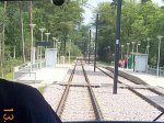
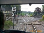
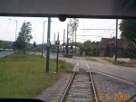
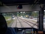
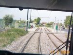
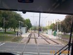
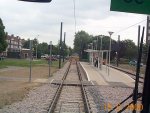
From Sandilands Junction, the route turns sharply to the right and joins the old cutting of the Woodside and South Croydon Railway which closed in 1983. The route enters the first of 3 tunnels - Woodside Tunnel which is 243m in length. There is a short (5 metre) gap before Park Hill Tunnel which was built in the early part of the century as a cut and cover tunnel to cope with slipping problems with the old cutting. This is 112m long. The final tunnel again after only a few metres is Coombe Road Tunnel - 144m. Emerging from this, the route continues along the old railway and crosses Fairfield Path on a new overbridge to reach the site of the old Coombe Road Station. In 1986, the station site was turned into a housing estate - Larcombe Close. Much of this has now been demolished and Larcombe Close moved West of its previous position. The route crosses the access to some garages and descends to Road level before turning very sharply to the left by almost 120 degrees. The old route went straight crossing Coombe Road on a bridge and continuing to Selsdon Jn and Sanderstead on the embankment that is still visible. A tramstop on this site was turned down after complaints from the Park Hill Residents association. After rounding the curve, the route crosses Lloyd Park Avenue before running alongside the Park to Lloyd Park Tramstop. This is the one on which one of the main artists impressions of the system is set. Immediately after the stop is a Level Crossing over the Car Park Access road. After crossing the Emergency Access to the park (gated and locked) there is a trailing crossover enabling trams to turn back. The route starts to climb into the woodland of the Addington Hills and it crosses the concealed entrance to Geoffrey Harris House before reaching Oaks Road Level Crossing. This is protected by traffic lights and there is a Sub Station. The route continues to climb, now on embankment and a foot crossing goes across. The parallel Coombe Road now curves away for a steep, sharply curved section whilst the tram has a gentler climb through the spectacular new cutting which is superb for photography. There is an emergency access crossing to the Reservoir near Royal Russell School. The route curves slightly left and reaches Coombe Lane Tramstop. This is one of the systems most remote and is in Woodland. After another foot crossing, the route curves right and climbs to Cross the main road at the summit of Gravel Hill. A cut and cover tunnel was planned here to ease the gradients and avoid congestion but this was dropped to lower the cost of the project to an acceptable level. The route turns left to follow parallel on the other side of the road and drops sharply. This is the second steepest section of the route only to Crown Hill in Central Croydon. It is the steepest uphill section in the Croydon direction at I believe 7%. The route continues to drop and is on the edge of Heathfield farm at this point. There is a road crossing for farm access before reaching Gravel Hill Tramstop which is opposite the entrance the Addington Palace and a Pedestrian Bridge over the main road. After the stop the route swings back to the North side of the road with another Level Crossing - The swapping is due to both the positioning of houses and the gradient. Now running along the edge of Addington Park the route continues down to the bottom before turning fairly sharply left and then across the access to Addington Park and the eastbound carriageway of Kent Gate Way. For a short section, it runs in the Central reservation before turning right and crossing the westbound carriageway to cut of the corner of Lodge Lane and the roundabout. This is the site for Addington Village Tramstop which is poorly located for the village and primarily designed as an interchange with bus services. There is a large new bus interchange here. All passing buses serve it as well as dedicated Tramlink Feeder Buses T31, T32 and T33. These connect with trams and run around the New Addington, Forrestdale and Selsdon Areas. Many changes were made to local buses here to avoid duplicate routes - Some changes like the scaling down of the 130 route to Croydon have proved very controversial with local residents. Passing the sub station and crossing a farm access road, the route climbs again passing another trailing crossover and running parallel with Lodge Lane - The main route into the estate. It is right next to the road and "Safticurb" and anti-dazzle posts have been installed. There is a stop at Fieldway to serve the main road into the Fieldway Estate (not an area to be recommended!). The route continues up to cross through the centre of King Henry's Drive Roundabout which is very large. The route then continues in grassland inside Parkway to King Henry's Drive Stop. After crossing some roads cutting off what is effectively a very long roundabout, the route narrows to single track to pass behind Parkway Health Centre before crossing the new Bus Stop and Bus Stand Crossing and splitting for the Island Platform. The route terminates and the end of the long "roundabout" with the road rounding the buffers. Across the Road is the Central Parade with shops and local amenities. Plans to continue the route further and terminate at the Parade were also dropped to save money although 2534 did try the route out during driver training causing extensive damage to the front end! New Addington may not be the nicest part of London but it is the main reason for constructing Tramlink as it was one of the largest estates in London not served by rail. |
|
Where do you want to go now? |
|
Wimbledon | Through the Depot | Central Croydon | Beckenham / Elmers End |
|
|
| Designed by Trapdoor Internet Services |
